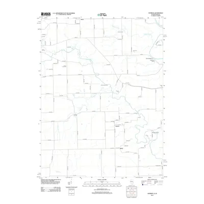
2012 Map of Humrick
USGS Topo · Published 2012About this map
Humrick and Bethel sit along the border of Illinois and Indiana, where a grid of rural roads meets the winding courses of the Little Vermilion River and Vermilion River. This 2012 survey captures a landscape defined by its waterways and small, localized settlements. To the north, the small community of Meeks lies near the Whippoorwill Br, while the southern reaches are marked by the drainage of Yankee Br and Jonathan Cr. Significant for local history and genealogy, the map identifies numerous family-named and community burial sites, including Elwood Church Cem, Yankee Point Cem, and Whitlock Cem. Physical landmarks such as the Devils Backbone, Deadmans Hollow, and the prominent Horseshoe Bend along the river illustrate the varied topography that breaks the pattern of agricultural sections. The map also shows recreational and community spaces like Camp Assurance and Cherokee Hills Camp along the river banks.
Find a feature on this map
95 named features on this map. Tap any name to fly to it.
Don’t see what you’re looking for? This feature index may not catch every label — zoom into the map to look around manually.
Map Details
Editions of this 2012 Humrick Map
This is the sole edition of this map. No revisions or reprints were ever made.
Other maps of this area

1899 · Danville
USGS Topo · 1:62,500

1900 · Danville
USGS Topo · 1:62,500

1947 · Ridge Farm
USGS Topo · 1:62,500

1949 · Danville SW
USGS Topo · 1:24,000

1950 · Danville SW
USGS Topo · 1:24,000

1950 · Danville SE
USGS Topo · 1:24,000

1951 · Danville SE
USGS Topo · 1:24,000

1953 · Danville
USGS Topo · 1:250,000

1953 · Indianapolis
USGS Topo · 1:250,000

1955 · Danville
USGS Topo · 1:250,000