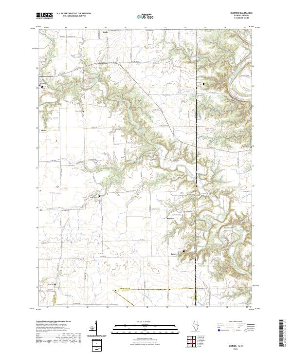
2024 Map of Humrick
USGS Topo · Published 2024About this map
Humrick and Bethel sit along the Illinois and Indiana border in this recent survey of Vermilion County. The landscape is defined by the winding course of the Little Vermilion River, which carves through the terrain to create distinctive features like Devils Backbone, Deadmans Hollow, and the prominent Horseshoe Bend. To the north, the Vermilion River meets the Whippoorwill Branch, while the southern reaches of the map are drained by the Salt Fork and Jonathan Creek near the border with Edgar County.
Find a feature on this map
59 named features on this map. Tap any name to fly to it.
Don’t see what you’re looking for? This feature index may not catch every label — zoom into the map to look around manually.
Map Details
Editions of this 2024 Humrick Map
This is the sole edition of this map. No revisions or reprints were ever made.
Other maps of this area

1899 · Danville
USGS Topo · 1:62,500

1900 · Danville
USGS Topo · 1:62,500

1947 · Ridge Farm
USGS Topo · 1:62,500

1949 · Danville SW
USGS Topo · 1:24,000

1950 · Danville SW
USGS Topo · 1:24,000

1950 · Danville SE
USGS Topo · 1:24,000

1951 · Danville SE
USGS Topo · 1:24,000

1953 · Danville
USGS Topo · 1:250,000

1953 · Indianapolis
USGS Topo · 1:250,000

1955 · Danville
USGS Topo · 1:250,000