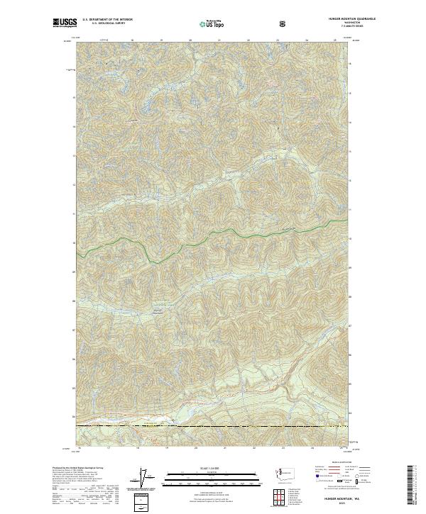
2023 Map of Hunger Mountain
USGS Topo · Published 2023About this map
Olympic National Park and the adjacent Olympic Wilderness dominate this western Washington landscape, where the high ridges of the Olympic Mountains give rise to a complex network of glacial and snowmelt drainage. The map centers on the headwaters and tributaries of major coastal river systems, including the westward-flowing Bogachiel River and the South Fork Calawah River. This modern survey illustrates a heavily protected backcountry defined by topographic extremes rather than permanent settlements. High-elevation landmarks like Hunger Mtn and the appropriately named Rugged Ridge divide the steep valleys. Human access is primarily represented by historical and recreational footpaths, most notably the Pacific Northwest National Scenic Trl and the South Snyder-Jackson Primitive Trl, which follow the natural contours and riverbanks of the Olympic National Forest.
Find a feature on this map
47 named features on this map. Tap any name to fly to it.
Don’t see what you’re looking for? This feature index may not catch every label — zoom into the map to look around manually.
Map Details
Editions of this 2023 Hunger Mountain Map
This is the sole edition of this map. No revisions or reprints were ever made.
Other maps of this area

1918 · Lake Crescent
USGS Topo · 1:62,500

1922 · Pysht
USGS Topo · 1:62,500

1922 · Lake Crescent
USGS Topo · 1:62,500

1939 · Mount Tom
USGS Topo · 1:62,500

1942 · Pysht
USGS Topo · 1:62,500

1943 · Spruce Mountain
USGS Topo · 1:62,500

1943 · Copalis Beach
USGS Topo · 1:250,000

1950 · Mount Muller
USGS Topo · 1:24,000

1950 · Slide Peak
USGS Topo · 1:24,000
1950 · Lake Crescent
USGS Topo · 1:62,500