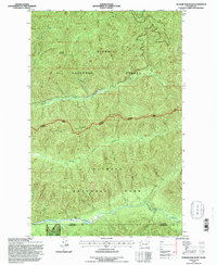
1995 Map of Hunger Mountain
USGS Topo · Published 1997About this map
Hunger Mountain stands at the center of this 1990s Olympic Peninsula survey, where the dense drainage networks of the northern rainforest meet the high divides. The map documents a significant intersection of public lands, clearly demarcating the National Forest National Park Boundary that separates the Olympic National Forest from Olympic National Park. This boundary follows the high spine of Rugged Ridge, a major geographical feature that dictates the flow of numerous waterways including the Sitkum River and the South Fork Calawah River.
Find a feature on this map
21 named features on this map. Tap any name to fly to it.
Don’t see what you’re looking for? This feature index may not catch every label — zoom into the map to look around manually.
Map Details
Editions of this 1995 Hunger Mountain Map
This is the sole edition of this map. No revisions or reprints were ever made.
Other maps of this area

1918 · Lake Crescent
USGS Topo · 1:62,500

1922 · Pysht
USGS Topo · 1:62,500

1922 · Lake Crescent
USGS Topo · 1:62,500

1939 · Mount Tom
USGS Topo · 1:62,500

1942 · Pysht
USGS Topo · 1:62,500

1943 · Spruce Mountain
USGS Topo · 1:62,500

1943 · Copalis Beach
USGS Topo · 1:250,000

1950 · Mount Muller
USGS Topo · 1:24,000

1950 · Slide Peak
USGS Topo · 1:24,000
1950 · Lake Crescent
USGS Topo · 1:62,500