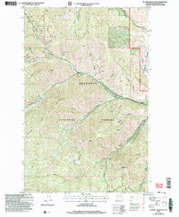
2002 Map of Hunger Mountain
USGS Topo · Published 2006About this map
Hungry Mountain and the high elevation ridgelines of the Okanogan National Forest dominate this landscape during the transition to the 21st century. The map details a complex drainage system where the North Fork Gold Creek, Middle Fork Gold Creek, and South Fork Gold Creek converge, eventually flowing toward the Methow Valley. Evidence of earlier resource extraction persists in the form of scattered prospects and adits found along the steep slopes of Gold Ridge and Raven Ridge. The eastern edge of the survey transitions from these mountainous heights into the Methow River corridor, showing established infrastructure like the Bear Creek Camp and a roadside Rest Area. This revision highlights the distinction between the surveyed forest lands and numerous protracted blocks, such as pb41 and pb54, which remained as unsurveyed territory of uncertain acreage at the time of the update.
Find a feature on this map
47 named features on this map. Tap any name to fly to it.
Don’t see what you’re looking for? This feature index may not catch every label — zoom into the map to look around manually.
Map Details
Editions of this 2002 Hunger Mountain Map
This is the sole edition of this map. No revisions or reprints were ever made.
Other maps of this area

1918 · Lake Crescent
USGS Topo · 1:62,500

1922 · Pysht
USGS Topo · 1:62,500

1922 · Lake Crescent
USGS Topo · 1:62,500

1939 · Mount Tom
USGS Topo · 1:62,500

1942 · Pysht
USGS Topo · 1:62,500

1943 · Spruce Mountain
USGS Topo · 1:62,500

1943 · Copalis Beach
USGS Topo · 1:250,000

1950 · Mount Muller
USGS Topo · 1:24,000

1950 · Slide Peak
USGS Topo · 1:24,000
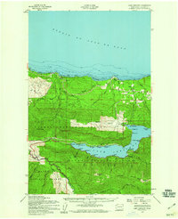
1950 · Lake Crescent
USGS Topo · 1:62,500