
1955 Map of Hunters Point
USGS Topo · Published 1956About this map
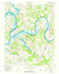
Old Hickory Reservoir dominates this mid-1950s landscape, where the rising waters of the Cumberland River reshape the historic bends of Wilson and Sumner Counties. The transition from river to reservoir is evident in the blue-shaded areas subject to inundation, particularly around Cunningham Island and the meandering Bledsoe Creek. On the high ground, numerous rural institutions such as Philadelphia Ch and Carroll Sch suggest a close-knit agricultural community established long before the dam projects. Ancient river travel is still remembered through road names like Coles Ferry Road and Belotes Ferry Road, indicating where the river was once crossed by watercraft rather than the modern Nathan J Harsh Bridge. Small settlements like Cairo and Oakland serve as local hubs, surrounded by family cemeteries such as Conatser Cem and Barnes Cem that ground the geography in local genealogy.
Find a feature on this map
48 named features on this map. Tap any name to fly to it.
Don’t see what you’re looking for? This feature index may not catch every label — zoom into the map to look around manually.
Map Details
Editions of this 1955 Hunters Point Map
4 editions found
Other maps of this area

1942 · Statesville
USGS Topo · 1:100,000

1942 · Gallatin
USGS Topo · 1:100,000

1942 · Lebanon
USGS Topo · 1:100,000

1951 · Lebanon
USGS Topo · 1:24,000

1951 · Martha
USGS Topo · 1:24,000

1955 · Bethpage
USGS Topo · 1:24,000

1955 · Laguardo
USGS Topo · 1:24,000

1955 · Gallatin
USGS Topo · 1:24,000

1956 · Nashville
USGS Topo · 1:250,000

1958 · Bellwood
USGS Topo · 1:24,000