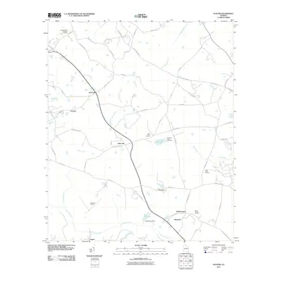
2011 Map of Hunters
USGS Topo · Published 2011About this map
The agricultural landscape of Screven County is anchored by the settlement of Hunters, where a network of rural roads connects scattered communities in the early 21st century. The terrain is defined by the slow-moving waters of the Ogeechee Creek and several significant impoundments, including Grist Mill Pond and Kimberly-Clark Lake, both featuring labeled dams that indicate the area's managed water resources. Small settlements like Green Hill, Farmdale, White Hill, and Middleground suggest a history of localized rural centers often built around family farms and early post offices.
Find a feature on this map
57 named features on this map. Tap any name to fly to it.
Don’t see what you’re looking for? This feature index may not catch every label — zoom into the map to look around manually.
Map Details
Editions of this 2011 Hunters Map
This is the sole edition of this map. No revisions or reprints were ever made.
Other maps of this area

1918 · Oliver
USGS Topo · 1:62,500

1919 · Shirley
USGS Topo · 1:62,500

1920 · Hilltonia
USGS Topo · 1:62,500

1920 · Oliver
USGS Topo · 1:62,500

1920 · Peeples
USGS Topo · 1:62,500

1943 · Hilltonia
USGS Topo · 1:62,500

1943 · Peeples
USGS Topo · 1:62,500

1943 · Shirley
USGS Topo · 1:62,500

1943 · Millen
USGS Topo · 1:125,000

1943 · Oliver
USGS Topo · 1:62,500