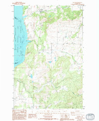
1985 Map of Hunters
USGS Topo · Published 1994About this map
Hunters and Fruitland serve as the primary residential hubs in this Stevens County landscape, situated just east of the expansive Columbia River and Lake Roosevelt. The topography is defined by significant elevation changes, ranging from the river banks to high points like Bald and Boundary Butte. Tribal lands are prominent, with the Spokane Indian Reservation occupying the southern portion of the sheet and the Colville Indian Reservation appearing across the water to the west. Local industry and resource extraction are evidenced by the H and B Mine and several borrow pits scattered near Alder Creek. Water features such as Newbill Lake, Mudgett Lake, and the drainage of O-Ra-Pak-En Creek suggest a terrain where small-scale agriculture in Enterprise Valley meets the managed wilderness of the Coulee Dam National Recreation Area.
Find a feature on this map
24 named features on this map. Tap any name to fly to it.
Don’t see what you’re looking for? This feature index may not catch every label — zoom into the map to look around manually.
Map Details
Editions of this 1985 Hunters Map
2 editions found
Other maps of this area

1948 · Hunters
USGS Topo · 1:62,500

1948 · Wilmont Creek
USGS Topo · 1:62,500

1948 · Lincoln
USGS Topo · 1:62,500

1948 · Turtle Lake
USGS Topo · 1:62,500

1950 · Lincoln
USGS Topo · 1:62,500

1950 · Turtle Lake
USGS Topo · 1:62,500

1950 · Wilmont Creek
USGS Topo · 1:62,500

1950 · Hunters
USGS Topo · 1:62,500

1953 · Ritzville
USGS Topo · 1:250,000

1954 · Okanogan
USGS Topo · 1:250,000