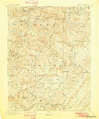
1894 Map of Huntersville
USGS Topo · Published 1902About this map
The Hillsboro Academy stands as a focal point of education in this late 19th-century reconnaissance survey of the high mountain gaps and river valleys where the Gauley River and Elk River originate. The landscape is defined by its early settlement patterns, with Huntersville and Marlinton serving as established hubs amidst a network of mountain ridges like Red Lick Mtn. and Droop Mtn.. These maps were crucial for navigating the complex geography before modern infrastructure, showing the relationship between small outposts like Hunter Place and the drainage basins of the Williams River. The survey captures a moment when local life was deeply tied to the terrain, from the Mingo Flat valley to the heights of Spruce Knob, illustrating how early West Virginia pioneers adapted to the steep divides and winding watercourses of the Allegheny range.
Find a feature on this map
210 named features on this map. Tap any name to fly to it.
Don’t see what you’re looking for? This feature index may not catch every label — zoom into the map to look around manually.
Map Details
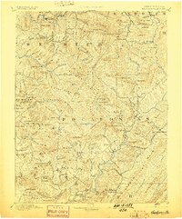
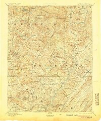
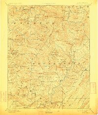
Editions of this 1894 Huntersville Map
5 editions found

Other maps of this area

1887 · Hinton
USGS Topo · 1:125,000

1887 · Lewisburg
USGS Topo · 1:125,000

1889 · Nicholas
USGS Topo · 1:125,000

1889 · Beverly
USGS Topo · 1:125,000

1891 · Lewisburg
USGS Topo · 1:125,000

1891 · Nicholas
USGS Topo · 1:125,000

1891 · Huntersville
USGS Topo · 1:125,000

1892 · Beverly
USGS Topo · 1:125,000

1892 · Hinton
USGS Topo · 1:125,000

1893 · Buckhannon
USGS Topo · 1:125,000
Featured Places
- Marlinton, WV
- Addison (Webster Springs), WV
- Webster Springs, Addison (Webster Springs)
- Hillsboro, WV
- Upper Mingo, WV