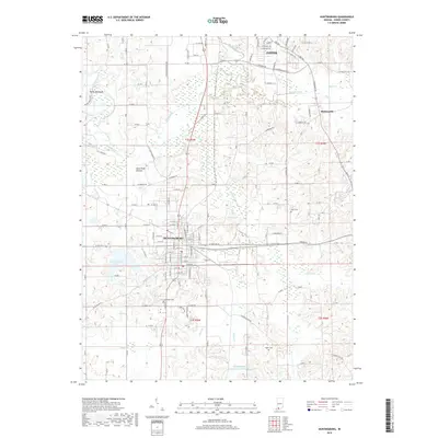
2019 Map of Huntingburg
USGS Topo · Published 2019About this map
Huntingburg and the southern reaches of Jasper anchor this Dubois County survey, showcasing the complex intersection of heavy rail and river hydrology. The Norfolk Southern railway cuts a clean east-west line through the heart of Huntingburg, passing just south of Knebel Lake and the marshy expanses of Duck Pond Bottom. This area is defined by its water systems, where the Patoka River winds through the northern sections near the distinctive Devils Backbone ridge, while the Straight River and Hunley Cr drain the central lowlands. Genealogists and local researchers will find several notable burial sites documented, including Fairmount Cem on the southern edge of the city and the rural Hagen Cem located near the Huntingburg Conservation Club Lake. The settlement of Maltersville appears in the northeast, marking a secondary point of historic interest amidst the agricultural and forested landscape.
Find a feature on this map
78 named features on this map. Tap any name to fly to it.
Don’t see what you’re looking for? This feature index may not catch every label — zoom into the map to look around manually.
Map Details
Editions of this 2019 Huntingburg Map
This is the sole edition of this map. No revisions or reprints were ever made.
Other maps of this area

1900 · St Meinrad
USGS Topo · 1:62,500

1900 · De Gonia Springs
USGS Topo · 1:62,500

1902 · Ditney
USGS Topo · 1:125,000

1902 · Degonia Springs
USGS Topo · 1:62,500

1903 · St. Meinrad
USGS Topo · 1:62,500

1903 · Velpen
USGS Topo · 1:62,500

1946 · Jasper
USGS Topo · 1:24,000

1954 · Dubois
USGS Topo · 1:24,000

1954 · Huntingburg
USGS Topo · 1:24,000

1955 · Saint Anthony
USGS Topo · 1:24,000