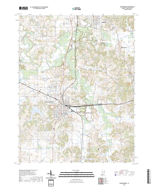
2022 Map of Huntingburg
USGS Topo · Published 2022About this map
Huntingburg and the southern edge of Jasper anchor this Dubois County landscape, where the Norfolk Southern railroad cuts through the heart of the community. The map illustrates a developed corridor along Indiana 162 and Main Street, connecting residential sectors with civic landmarks like the Huntingburg School and the local Post Office. Beyond the town centers, the terrain transitions into the floodplains and ridges of the Patoka River valley, including the curiously named Devils Backbone and Duck Pond Bottom.
Find a feature on this map
142 named features on this map. Tap any name to fly to it.
Don’t see what you’re looking for? This feature index may not catch every label — zoom into the map to look around manually.
Map Details
Editions of this 2022 Huntingburg Map
This is the sole edition of this map. No revisions or reprints were ever made.
Other maps of this area

1900 · St Meinrad
USGS Topo · 1:62,500

1900 · De Gonia Springs
USGS Topo · 1:62,500

1902 · Ditney
USGS Topo · 1:125,000

1902 · Degonia Springs
USGS Topo · 1:62,500

1903 · St. Meinrad
USGS Topo · 1:62,500

1903 · Velpen
USGS Topo · 1:62,500

1946 · Jasper
USGS Topo · 1:24,000

1954 · Dubois
USGS Topo · 1:24,000

1954 · Huntingburg
USGS Topo · 1:24,000

1955 · Saint Anthony
USGS Topo · 1:24,000