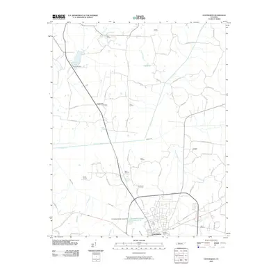
2010 Map of Huntingdon
USGS Topo · Published 2010About this map
Huntingdon and the surrounding Tennessee landscape are defined by a complex network of tributaries and small rural cemeteries in this 2010 survey. The area is intersected by watercourses including Beaver Creek, Crooked Creek, and Guins Creek, which weave through a rural layout of farm-to-market roads such as Hilliard Rd and Thompson School Rd. Notable landmarks include Carroll Lake and the Carroll Lake Dam to the northwest, alongside the more industrial Huntingdon Sewage Lagoon Lake to the south.
Find a feature on this map
64 named features on this map. Tap any name to fly to it.
Don’t see what you’re looking for? This feature index may not catch every label — zoom into the map to look around manually.
Map Details
Editions of this 2010 Huntingdon Map
This is the sole edition of this map. No revisions or reprints were ever made.
Other maps of this area

1936 · Mansfield
USGS Topo · 1:24,000

1936 · Vale
USGS Topo · 1:24,000

1936 · Center Ridge
USGS Topo · 1:24,000

1936 · Buena Vista
USGS Topo · 1:24,000

1950 · Palmer Shelter
USGS Topo · 1:24,000

1950 · Vale
USGS Topo · 1:24,000
1950 · Buena Vista
USGS Topo · 1:24,000

1950 · Mansfield
USGS Topo · 1:24,000

1955 · Henry
USGS Topo · 1:24,000

1955 · Huntingdon
USGS Topo · 1:24,000