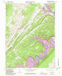
1963 Map of Huntingdon
USGS Topo · Published 1982About this map
Huntingdon serves as the focal point for this survey, situated at a major bend in the Juniata River where industrial and educational centers meet. The map documents the presence of Juniata College and the State Correctional Institution alongside civil landmarks like the Blair Memorial Hospital and the county Court House. To the south, the dramatic meandering path of the Raystown Branch Juniata River dominates the landscape as it fills Raystown Lake, a massive reservoir that altered the local topography.
Find a feature on this map
53 named features on this map. Tap any name to fly to it.
Don’t see what you’re looking for? This feature index may not catch every label — zoom into the map to look around manually.
Map Details
Editions of this 1963 Huntingdon Map
4 editions found
Other maps of this area

1901 · Huntingdon
USGS Topo · 1:62,500

1904 · Huntingdon
USGS Topo · 1:62,500

1919 · Menno
USGS Topo · 1:62,500

1922 · Mt Union
USGS Topo · 1:48,000

1923 · Tyrone
USGS Topo · 1:62,500

1924 · Mt. Union
USGS Topo · 1:62,500

1929 · Tyrone
USGS Topo · 1:48,000

1933 · Tyrone
USGS Topo · 1:62,500

1935 · Allensville
USGS Topo · 1:62,500

1938 · Allensville
USGS Topo · 1:62,500