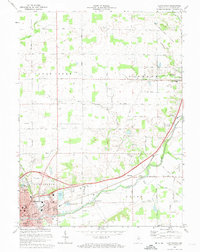
1972 Map of Huntington
USGS Topo · Published 1974About this map
The industrial and residential growth of Huntington dominates the southwestern corner of this survey, where the Norfolk and Western and Erie Lackawanna railroads converge. This transit hub supports local education and recreation, seen in the proximity of Crestview Jr High Sch, Horace Mann Sch, and Riverside Park. Beyond the city, the landscape transitions into a network of small agricultural settlements and rural landmarks like Roanoke, Mardenis, and Bowerstown.
Find a feature on this map
44 named features on this map. Tap any name to fly to it.
Don’t see what you’re looking for? This feature index may not catch every label — zoom into the map to look around manually.
Map Details
Editions of this 1972 Huntington Map
Other maps of this area

1950 · Andrews
USGS Topo · 1:24,000

1951 · Andrews
USGS Topo · 1:24,000

1952 · Majenica
USGS Topo · 1:24,000

1953 · Fort Wayne
USGS Topo · 1:250,000

1953 · Muncie
USGS Topo · 1:250,000

1955 · Markle
USGS Topo · 1:24,000

1955 · Bippus
USGS Topo · 1:24,000

1956 · Muncie
USGS Topo · 1:250,000

1956 · Fort Wayne
USGS Topo · 1:250,000

1956 · Huntington
USGS Topo · 1:24,000