
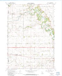
1967 Map of Huntley
USGS Topo · Published 1969About this map
Center Creek and the meandering Blue Earth River define the landscape of Faribault County during the late 1960s. This agricultural region is bisected by significant transportation corridors, including the Chicago Milwaukee St Paul and Pacific railroad passing through Huntley, and the Chicago and North Western line serving Guckeen. The map illustrates a highly managed water system, dominated by numerous man-made drainage structures like Judicial Ditch No 4 and Judicial Ditch No 2, which supported the surrounding prairie farms.
Find a feature on this map
26 named features on this map. Tap any name to fly to it.
Don’t see what you’re looking for? This feature index may not catch every label — zoom into the map to look around manually.
Map Details
Editions of this 1967 Huntley Map
2 editions found
Other maps of this area

1954 · Fairmont
USGS Topo · 1:250,000

1958 · Fairmont
USGS Topo · 1:250,000

1967 · Pilot Grove
USGS Topo · 1:24,000

1967 · East Chain
USGS Topo · 1:24,000

1967 · Truman SE
USGS Topo · 1:24,000

1967 · Winnebago
USGS Topo · 1:24,000

1967 · Elmore
USGS Topo · 1:24,000

1967 · Granada
USGS Topo · 1:24,000
1967 · Delavan
USGS Topo · 1:24,000
1967 · Blue Earth
USGS Topo · 1:24,000