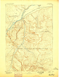
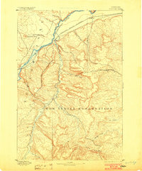
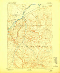
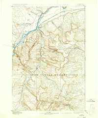
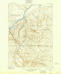
1893 Map of Huntley
USGS Topo · Published 1898About this map
The Crow Indian Reservation dominates the southern landscape of this 1891 survey, its Western Boundary clearly delineated as it cuts across the rugged drainage basins of Pryor Creek and East Pryor Creek. To the north, the Yellowstone River serves as a primary geographic corridor, flanked by the Northern Pacific Railroad which connects the nascent settlements of Huntley and Clermont.
Find a feature on this map
22 named features on this map. Tap any name to fly to it.
Don’t see what you’re looking for? This feature index may not catch every label — zoom into the map to look around manually.
Map Details
Editions of this 1893 Huntley Map
6 editions found
Other maps of this area

1893 · Huntley
USGS Topo · 1:125,000

1894 · St. Xavier
USGS Topo · 1:125,000

1894 · Fort Custer
USGS Topo · 1:125,000

1901 · St. Xavier
USGS Topo · 1:125,000

1915 · Spenceville
USGS Topo · 1:31,680

1954 · Billings
USGS Topo · 1:250,000

1954 · Hardin
USGS Topo · 1:250,000

1954 · Forsyth
USGS Topo · 1:250,000

1954 · Roundup
USGS Topo · 1:250,000
1956 · Rattlesnake Butte
USGS Topo · 1:24,000