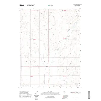
2018 Map of Huntsman Ranch
USGS Topo · Published 2018About this map
Huntsman Ranch serves as a lone marker of habitation in this high-desert region of Elko County, situated amidst the dramatic elevations of the Adobe Range. The landscape is defined by its complex drainage network, where the waters of Susie Cr and Dry Susie Cr carve through the arid terrain. One of the most significant historical features on this sheet is the Greenhorn Cutoff, a branch of the California Trail that offered emigrants a shortcut through the Great Basin. This route passes near several vital water sources such as Hot Springs and the Lower Dry Susie Spring. Further south, the meandering Maggie Cr provides another notable hydrological landmark. The map documents a landscape where traditional ranching and historic transcontinental migration paths converge within a sparsely populated basin.
Find a feature on this map
15 named features on this map. Tap any name to fly to it.
Don’t see what you’re looking for? This feature index may not catch every label — zoom into the map to look around manually.
Map Details
Editions of this 2018 Huntsman Ranch Map
This is the sole edition of this map. No revisions or reprints were ever made.
Other maps of this area

1952 · Dixie Flats
USGS Topo · 1:62,500

1952 · Carlin
USGS Topo · 1:62,500

1955 · Winnemucca
USGS Topo · 1:250,000

1955 · Elko
USGS Topo · 1:250,000

1958 · Winnemucca
USGS Topo · 1:250,000

1958 · Elko
USGS Topo · 1:250,000

1958 · Hunter
USGS Topo · 1:24,000

1958 · Huntsman Ranch
USGS Topo · 1:24,000

1958 · Doby Summit
USGS Topo · 1:24,000
1958 · Swales Mountain
USGS Topo · 1:24,000