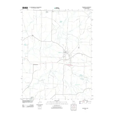
2012 Map of Huntsville
USGS Topo · Published 2012About this map
Huntsville serves as a central hub in this portion of Missouri, where the East Fork Little Chariton River and Sugar Creek define the local topography. The map reveals a landscape managed for water resources, featuring numerous engineered structures such as Millers Lake Dam, Kelley Lake Dam, and the Vanderback Lake Section 21 Dam. These reservoirs, along with Porth Lake and Lake Wata, illustrate the shift toward recreational and agricultural water management in the rural areas surrounding the primary settlements.
Find a feature on this map
63 named features on this map. Tap any name to fly to it.
Don’t see what you’re looking for? This feature index may not catch every label — zoom into the map to look around manually.
Map Details
Editions of this 2012 Huntsville Map
This is the sole edition of this map. No revisions or reprints were ever made.
Other maps of this area

1890 · Moberly
USGS Topo · 1:125,000

1890 · Glasgow
USGS Topo · 1:125,000

1908 · Macon
USGS Topo · 1:62,500

1910 · Macon
USGS Topo · 1:62,500

1953 · Moberly
USGS Topo · 1:250,000

1953 · Renick
USGS Topo · 1:24,000

1953 · Huntsville
USGS Topo · 1:24,000

1953 · Higbee
USGS Topo · 1:24,000

1953 · College Mound
USGS Topo · 1:24,000

1953 · Armstrong
USGS Topo · 1:24,000