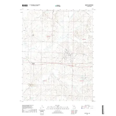
2017 Map of Huntsville
USGS Topo · Published 2017About this map
Huntsville serves as the primary hub of this north-central Missouri landscape, situated near the confluence of several rural waterways including Sugar Cr and the E Fork Little Chariton River. The terrain is defined by a dense network of county roads that connect the town to outlying points like Fort Henry and the local mineral waters area of Randolph Springs. Genealogists will find notable points of interest such as Trinity Cem in the north and Hagar Cem to the southeast, marking long-established burial sites within the township boundaries. The area is also notable for its numerous small water bodies, including Wallace Ryals Lake and Porth Lake, reflecting a landscape heavily modified for local recreation and agriculture. Tracing the path of Sweet Spring Cr reveals the undulating drainage patterns that have historically shaped settlement in Randolph County.
Find a feature on this map
88 named features on this map. Tap any name to fly to it.
Don’t see what you’re looking for? This feature index may not catch every label — zoom into the map to look around manually.
Map Details
Editions of this 2017 Huntsville Map
This is the sole edition of this map. No revisions or reprints were ever made.
Other maps of this area

1890 · Moberly
USGS Topo · 1:125,000

1890 · Glasgow
USGS Topo · 1:125,000

1908 · Macon
USGS Topo · 1:62,500

1910 · Macon
USGS Topo · 1:62,500

1953 · Moberly
USGS Topo · 1:250,000

1953 · Renick
USGS Topo · 1:24,000

1953 · Huntsville
USGS Topo · 1:24,000

1953 · Higbee
USGS Topo · 1:24,000

1953 · College Mound
USGS Topo · 1:24,000

1953 · Armstrong
USGS Topo · 1:24,000