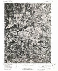
1980 Map of Huntsville
USGS Topo · Published 1982About this map
Huntsville serves as the primary focal point of this 1980 orthophotograph, situated where the wooded ravines of Randolph County meet organized agricultural plots. The imagery reveals a landscape defined by its waterways, most notably the winding course of the Little Chariton River and its East Fork, which carve through the terrain north of the town center. To the west, the settlement of Fort Henry occupies a position among the patchwork of fields and timber, while Randolph Springs is located to the southwest near the banks of Sweet Spring Creek. This survey provides a clear view of the rural infrastructure of the early 1980s, documenting the precise location of homesteads and road networks as they existed before modern expansion. The contrast between the dense vegetation along the creek bottoms and the cleared uplands illustrates the long-standing land-use patterns of this Missouri river-and-rail corridor.
Find a feature on this map
8 named features on this map. Tap any name to fly to it.
Don’t see what you’re looking for? This feature index may not catch every label — zoom into the map to look around manually.
Map Details
Editions of this 1980 Huntsville Map
This is the sole edition of this map. No revisions or reprints were ever made.
Other maps of this area

1890 · Moberly
USGS Topo · 1:125,000

1890 · Glasgow
USGS Topo · 1:125,000

1908 · Macon
USGS Topo · 1:62,500

1910 · Macon
USGS Topo · 1:62,500

1953 · Moberly
USGS Topo · 1:250,000

1953 · Renick
USGS Topo · 1:24,000

1953 · Huntsville
USGS Topo · 1:24,000

1953 · Higbee
USGS Topo · 1:24,000

1953 · College Mound
USGS Topo · 1:24,000

1953 · Armstrong
USGS Topo · 1:24,000