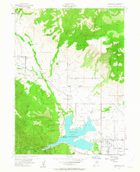
1955 Map of Huntsville
USGS Topo · Published 1963About this map
Pineview Reservoir dominates this mid-century landscape, acting as the hydrological anchor for the surrounding agricultural and mountain communities. The map details the complex irrigation network necessary for high-altitude farming, including the Mountain Canal, Huntsville South Ditch, and various unnamed channels that divert water from the North Fork Ogden River. Settlement patterns are concentrated in the valley floors at Huntsville, Eden, and Liberty, where local genealogy is anchored by the Mountain View Cemetery and Meadow View Cemetery.
Find a feature on this map
45 named features on this map. Tap any name to fly to it.
Don’t see what you’re looking for? This feature index may not catch every label — zoom into the map to look around manually.
Map Details
Editions of this 1955 Huntsville Map
4 editions found
Other maps of this area

1954 · Ogden
USGS Topo · 1:250,000

1955 · Ogden
USGS Topo · 1:24,000

1955 · Mantua
USGS Topo · 1:24,000

1955 · Huntsville
USGS Topo · 1:24,000

1955 · James Peak
USGS Topo · 1:24,000

1955 · North Ogden
USGS Topo · 1:24,000

1955 · Snow Basin
USGS Topo · 1:24,000

1958 · Ogden
USGS Topo · 1:250,000

1960 · Ogden
USGS Topo · 1:250,000

1961 · Morgan
USGS Topo · 1:62,500