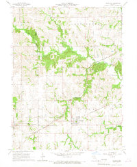
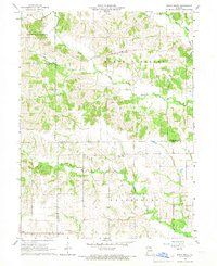
1966 Map of Hurdland
USGS Topo · Published 1967About this map
The railroad junction at Hurdland serves as the focal point of this mid-1960s agricultural landscape on the border of Adair and Knox counties. The town is situated at the crossing of two major lines, the Atchison Topeka and Santa Fe and the Chicago Burlington and Quincy, illustrating the historical importance of rail transport for Missouri's farming communities.
Find a feature on this map
18 named features on this map. Tap any name to fly to it.
Don’t see what you’re looking for? This feature index may not catch every label — zoom into the map to look around manually.
Map Details
Editions of this 1966 Hurdland Map
This is the sole edition of this map. No revisions or reprints were ever made.
Other maps of this area

1903 · Edina
USGS Topo · 1:125,000

1954 · Centerville
USGS Topo · 1:250,000

1957 · Centerville
USGS Topo · 1:250,000

1958 · Centerville
USGS Topo · 1:250,000
1965 · Edina
USGS Topo · 1:24,000
1965 · Novelty
USGS Topo · 1:24,000

1965 · Greensburg
USGS Topo · 1:24,000
1965 · Locust Hill
USGS Topo · 1:24,000

1966 · Brashear
USGS Topo · 1:24,000
1966 · Bible Grove
USGS Topo · 1:24,000