2021 Map of Hurley
USGS Topo · Published 2021About this map
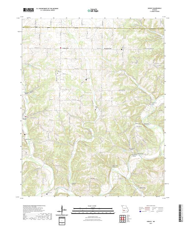
Hurley sits at the junction of Spring Cr and Crane Cr in a landscape defined by deep limestone drainages and prominent ridges. The area south of the Christian County line is characterized by family-named landmarks and small crossroads communities, such as Union City and Possum Trot. Significant topographic features include the Hootentown Natural Arch and Hooten Hill, which overlook the James River as it winds through the eastern portion of the quadrangle. Local heritage is preserved in numerous upland burial grounds, including Union Ridge Cem and the Molly Wright Cem. The drainage patterns here, from Silver Lake Br to the deeply inset Old Stillhouse Hollow, illustrate a terrain where early settlement followed the dependable waters of Jumbo Spring and Hayes Spring. Structural landmarks like the Hootentown Bridge and McCall Bridge provide critical crossings over the river system that historically shaped this part of Stone County.
Find a feature on this map
64 named features on this map. Tap any name to fly to it.
Don’t see what you’re looking for? This feature index may not catch every label — zoom into the map to look around manually.
Map Details
Editions of this 2021 Hurley Map
This is the sole edition of this map. No revisions or reprints were ever made.