
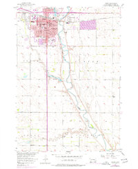
1957 Map of Huron
USGS Topo · Published 1958About this map
The city of Huron serves as the focal point of this mid-century survey, positioned at a critical junction where the Chicago and North Western railroad meets the winding James River. The map meticulously details a growing educational and civic infrastructure, noting local institutions such as Huron College, St Johns Hospital, and City Hall. Surrounding the urban center, the landscape is defined by the river’s floodplain and several smaller tributaries including Stony Run, Cain Creek, and Pearl Creek.
Find a feature on this map
45 named features on this map. Tap any name to fly to it.
Don’t see what you’re looking for? This feature index may not catch every label — zoom into the map to look around manually.
Map Details
Editions of this 1957 Huron Map
2 editions found
Other maps of this area

1898 · Huron
USGS Topo · 1:125,000

1953 · Huron
USGS Topo · 1:250,000

1954 · Huron
USGS Topo · 1:250,000

1957 · Forestburg NE
USGS Topo · 1:24,000

1957 · Cavour
USGS Topo · 1:24,000

1958 · Forestburg NW
USGS Topo · 1:24,000

1958 · Huron NW
USGS Topo · 1:24,000
1958 · Huron NE
USGS Topo · 1:24,000

1973 · Alpena
USGS Topo · 1:24,000
1973 · Broadland
USGS Topo · 1:24,000