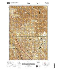
2020 Map of Huron
USGS Topo · Published 2020About this map
The Oregon Trail Nat'l Historic winds through this high-elevation landscape, tracing a path of American migration across the Blue Mountains. This modern survey captures the complex intersection of the Umatilla National Forest and Whitman National Forest, where the terrain transitions between the steep drainage of Meacham Cr and the flats of Strickland Flat. Local history is preserved at sites like the Rugg Cem and the California Gulch Interp, reflecting the region's ranching and pioneer heritage. The map details a specialized network of winter recreation trails, including the Blue Mtn Big Loop-Xc Ski (Snow) and the Butcher Loop (Snow), highlighting how this timbered backcountry is utilized today. Numerous named water sources, such as Lansing Spring and Nunamaker Pond, point to the essential water management required in this high country near the Umatilla and Union County line.
Find a feature on this map
50 named features on this map. Tap any name to fly to it.
Don’t see what you’re looking for? This feature index may not catch every label — zoom into the map to look around manually.
Map Details
Editions of this 2020 Huron Map
This is the sole edition of this map. No revisions or reprints were ever made.
Other maps of this area

1953 · Pendleton
USGS Topo · 1:250,000

1956 · Pendleton
USGS Topo · 1:250,000

1963 · Meacham Lake
USGS Topo · 1:24,000

1963 · Hilgard
USGS Topo · 1:24,000

1964 · Mc Intyre Creek
USGS Topo · 1:24,000

1964 · Duncan
USGS Topo · 1:24,000

1964 · Thimbleberry Mtn
USGS Topo · 1:24,000

1964 · Huron
USGS Topo · 1:24,000

1964 · Drumhill Ridge
USGS Topo · 1:24,000

1964 · Meacham
USGS Topo · 1:24,000