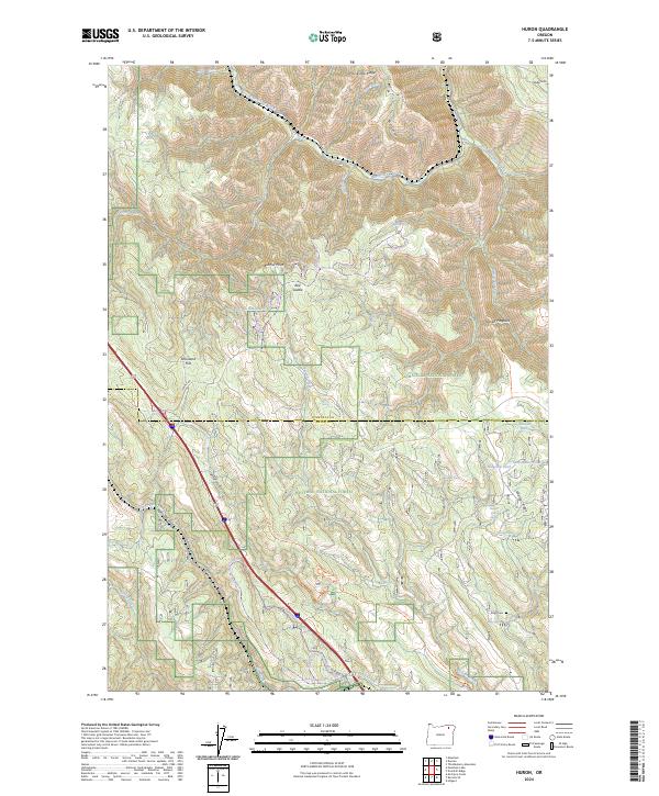
2024 Map of Huron
USGS Topo · Published 2024About this map
The Oregon Trail Nat'l Historic Trl cuts through this high-country landscape, tracing a legendary path of western migration across the border of Umatilla and Union Counties. This modern survey reveals a terrain defined by steep drainage systems and prominent ridges within the Umatilla National Forest and Whitman National Forest. The geography is anchored by Meacham Creek and its many tributaries, such as East Meacham Creek and Lillich Creek, which have carved deep features like Short Canyon and California Gulch.
Find a feature on this map
41 named features on this map. Tap any name to fly to it.
Don’t see what you’re looking for? This feature index may not catch every label — zoom into the map to look around manually.
Map Details
Editions of this 2024 Huron Map
This is the sole edition of this map. No revisions or reprints were ever made.
Other maps of this area

1953 · Pendleton
USGS Topo · 1:250,000

1956 · Pendleton
USGS Topo · 1:250,000

1963 · Meacham Lake
USGS Topo · 1:24,000

1963 · Hilgard
USGS Topo · 1:24,000

1964 · Mc Intyre Creek
USGS Topo · 1:24,000

1964 · Duncan
USGS Topo · 1:24,000

1964 · Thimbleberry Mtn
USGS Topo · 1:24,000

1964 · Huron
USGS Topo · 1:24,000

1964 · Drumhill Ridge
USGS Topo · 1:24,000

1964 · Meacham
USGS Topo · 1:24,000