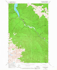
1950 Map of Hurricane Hill
USGS Topo · Published 1967About this map
The Elwha River carves a deep path through this mid-century look at the Olympic interior, centering on the steep walls of the Grand Canyon and the broadening Geyser Valley. This 1950 field-checked survey documents a landscape defined by high ridges and isolated back-country outposts like Michaels Ranch and Humes Ranch. To the north, Lake Mills dominates the valley floor, its waters reaching into Windy Arm beneath the heights of Hurricane Hill.
Find a feature on this map
40 named features on this map. Tap any name to fly to it.
Don’t see what you’re looking for? This feature index may not catch every label — zoom into the map to look around manually.
Map Details
Editions of this 1950 Hurricane Hill Map
5 editions found
Other maps of this area

1918 · Port Angeles
USGS Topo · 1:62,500

1919 · Port Crescent
USGS Topo · 1:62,500

1935 · Mount Olympus
USGS Topo · 1:62,500

1938 · Mt Constance
USGS Topo · 1:125,000

1941 · Port Angeles
USGS Topo · 1:62,500

1942 · Mount Olympus
USGS Topo · 1:62,500

1944 · Mt. Angeles
USGS Topo · 1:62,500

1946 · Mt. Angeles
USGS Topo · 1:62,500

1950 · Elwha
USGS Topo · 1:24,000

1950 · Hurricane Hill
USGS Topo · 1:24,000