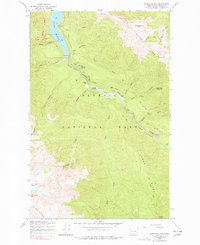
1950 Map of Hurricane Hill
USGS Topo · Published 1977About this map
Olympic National Park encompasses this high-elevation terrain within the Bailey Range, where the Elwha River cuts through prominent landmarks like Goblins Gate and Rica Canyon. Grounded in a 1950 field check, the survey documents a landscape of alpine glaciers and deep river valleys before modern environmental shifts. The mapping shows the early footprint of human habitation and recreation in the wilderness, featuring Humes Ranch and Michaels Ranch alongside the Lillian Shelter. The presence of Lake Mills and its associated campground near Windy Arm illustrates the intersection of water management and early park tourism. Extensive trail networks, including the Long Ridge Trail and Lillian River Trail, provide a window into the historic access routes used by foresters and early mountaineers across Long Ridge and up to Hurricane Hill.
Find a feature on this map
44 named features on this map. Tap any name to fly to it.
Don’t see what you’re looking for? This feature index may not catch every label — zoom into the map to look around manually.
Map Details
Editions of this 1950 Hurricane Hill Map
5 editions found
Other maps of this area

1918 · Port Angeles
USGS Topo · 1:62,500

1919 · Port Crescent
USGS Topo · 1:62,500

1935 · Mount Olympus
USGS Topo · 1:62,500

1938 · Mt Constance
USGS Topo · 1:125,000

1941 · Port Angeles
USGS Topo · 1:62,500

1942 · Mount Olympus
USGS Topo · 1:62,500

1944 · Mt. Angeles
USGS Topo · 1:62,500

1946 · Mt. Angeles
USGS Topo · 1:62,500

1950 · Elwha
USGS Topo · 1:24,000

1950 · Hurricane Hill
USGS Topo · 1:24,000