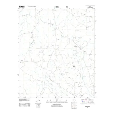
2010 Map of Hurstown
USGS Topo · Published 2010About this map
Hurstown and the surrounding Shelby County countryside are defined by a complex network of waterways and early burial grounds. The landscape is drained by southward-flowing streams including Bell Creek, Town Creek, and Lick Creek, which eventually feed into the broader Patroon Bayou at the southern edge of the survey. Small rural clusters like East Liberty and McClelland serve as local anchors, while the terrain is notable for Big Hill rising above the bottomlands. Genealogists will find this particular record invaluable due to the dense concentration of family and community burial sites, such as Biggers Cemetery, McWilliams Cemetery, and Rather Cemetery. The map also captures the transition from established farm-to-market roads to the intricate network of United States Forest Service routes, such as F S Road 100, reflecting the region's managed timber and agricultural character.
Find a feature on this map
58 named features on this map. Tap any name to fly to it.
Don’t see what you’re looking for? This feature index may not catch every label — zoom into the map to look around manually.
Map Details
Editions of this 2010 Hurstown Map
This is the sole edition of this map. No revisions or reprints were ever made.
Other maps of this area

1944 · Logansport
USGS Topo · 1:62,500

1944 · Patroon
USGS Topo · 1:62,500

1953 · Alexandria
USGS Topo · 1:250,000

1953 · Palestine
USGS Topo · 1:250,000

1955 · Alexandria
USGS Topo · 1:250,000

1956 · Logansport
USGS Topo · 1:62,500

1956 · Patroon
USGS Topo · 1:62,500

1957 · Palestine
USGS Topo · 1:250,000

1958 · Center
USGS Topo · 1:62,500

1958 · San Augustine
USGS Topo · 1:62,500