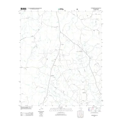
2013 Map of Hurstown
USGS Topo · Published 2013About this map
Hurstown and the surrounding rural landscape of Shelby County are defined by a network of creeks and small family cemeteries that speak to generations of local settlement. The terrain transitions from the heights of Big Hill down to the drainage basins of Patroon Bayou and Crooked Cr, where numerous small tributaries like Rascal Cr and Wooten Cr carve through the East Texas woods. This 2013 survey provides a detailed look at established communities such as McClelland and East Liberty, alongside isolated landmarks like Davis Ranch. Genealogists will find particular value in the distribution of burial sites across the quadrangle, ranging from Biggers Cem and Center Ridge Cem in the northwest to E Liberty Cem and Rather Cem in the southeast. The map documents the persistent rural character of the region, where Farm-to-Market roads and county lanes connect these historical points of interest.
Find a feature on this map
74 named features on this map. Tap any name to fly to it.
Don’t see what you’re looking for? This feature index may not catch every label — zoom into the map to look around manually.
Map Details
Editions of this 2013 Hurstown Map
This is the sole edition of this map. No revisions or reprints were ever made.
Other maps of this area

1944 · Logansport
USGS Topo · 1:62,500

1944 · Patroon
USGS Topo · 1:62,500

1953 · Alexandria
USGS Topo · 1:250,000

1953 · Palestine
USGS Topo · 1:250,000

1955 · Alexandria
USGS Topo · 1:250,000

1956 · Logansport
USGS Topo · 1:62,500

1956 · Patroon
USGS Topo · 1:62,500

1957 · Palestine
USGS Topo · 1:250,000

1958 · Center
USGS Topo · 1:62,500

1958 · San Augustine
USGS Topo · 1:62,500