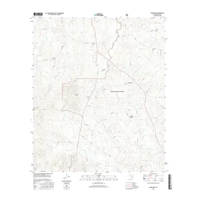
2016 Map of Hurstown
USGS Topo · Published 2016About this map
Sabine National Forest covers much of this East Texas terrain, where the headwaters of numerous creeks and bayous carve through the landscape. Small rural communities like East Liberty and Neuville are centered around crossroads and family cemeteries, including Neuville Cem and East Liberty Cem. The topographic relief is defined by prominent features such as Big Hill, which rises above the surrounding forest between Rascal Creek and Bell Creek. This map is particularly valuable for genealogists, as it meticulously identifies numerous burial sites across the countryside, such as Rather Cem, Adams Cem, and Biggers Cem. The drainage network is complex, with Patroon Bayou and its tributaries, including Wooten Creek and Crooked Creek, directing the flow of water through the wooded piney woods of Shelby County. Industrial and agricultural access is maintained through a network of forest roads and county routes like County Road 2130.
Find a feature on this map
66 named features on this map. Tap any name to fly to it.
Don’t see what you’re looking for? This feature index may not catch every label — zoom into the map to look around manually.
Map Details
Editions of this 2016 Hurstown Map
This is the sole edition of this map. No revisions or reprints were ever made.
Other maps of this area

1944 · Logansport
USGS Topo · 1:62,500

1944 · Patroon
USGS Topo · 1:62,500

1953 · Alexandria
USGS Topo · 1:250,000

1953 · Palestine
USGS Topo · 1:250,000

1955 · Alexandria
USGS Topo · 1:250,000

1956 · Logansport
USGS Topo · 1:62,500

1956 · Patroon
USGS Topo · 1:62,500

1957 · Palestine
USGS Topo · 1:250,000

1958 · Center
USGS Topo · 1:62,500

1958 · San Augustine
USGS Topo · 1:62,500