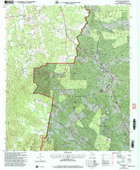
2003 Map of Hurstown
USGS Topo · Published 2004About this map
The Sabine National Forest dominates the southern landscape of this Shelby County region, where the terrain rises to the notable Big Hill near its center. A network of country roads connects isolated settlements and homesteads, reflecting a rural Texas community structured around its spiritual and ancestral landmarks. From the clustered namesake of Hursttown in the northeast to Mc Clelland in the west, the map preserves the locations of numerous family-named burial grounds like Biggers Cem and Creech Cem.
Find a feature on this map
36 named features on this map. Tap any name to fly to it.
Don’t see what you’re looking for? This feature index may not catch every label — zoom into the map to look around manually.
Map Details
Editions of this 2003 Hurstown Map
This is the sole edition of this map. No revisions or reprints were ever made.
Other maps of this area

1944 · Logansport
USGS Topo · 1:62,500

1944 · Patroon
USGS Topo · 1:62,500

1953 · Alexandria
USGS Topo · 1:250,000

1953 · Palestine
USGS Topo · 1:250,000

1955 · Alexandria
USGS Topo · 1:250,000

1956 · Logansport
USGS Topo · 1:62,500

1956 · Patroon
USGS Topo · 1:62,500

1957 · Palestine
USGS Topo · 1:250,000

1958 · Center
USGS Topo · 1:62,500

1958 · San Augustine
USGS Topo · 1:62,500