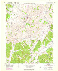
1952 Map of Hustonville
USGS Topo · Published 1979About this map
Hustonville serves as the focal point of this mid-century landscape, situated along the Hanging Fork at the intersection of several regional routes. The map illustrates a rural society organized around small crossroads and family-named landmarks, such as Kidds Store and the uniquely named Chicken Bristle. The drainage patterns of the Green River, Carpenter Creek, and Pine Lick Creek dictate the settlement distribution, with homes and community buildings clustered in the valleys between prominent elevations like Gordon Lick Knob and Fletcher Knob.
Find a feature on this map
46 named features on this map. Tap any name to fly to it.
Don’t see what you’re looking for? This feature index may not catch every label — zoom into the map to look around manually.
Map Details
Editions of this 1952 Hustonville Map
3 editions found
Other maps of this area

1905 · Harrodsburg
USGS Topo · 1:125,000

1952 · Ellisburg
USGS Topo · 1:24,000

1952 · Halls Gap
USGS Topo · 1:24,000

1952 · Eubank
USGS Topo · 1:24,000

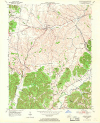
1952 · Hustonville
USGS Topo · 1:24,000

1952 · Liberty
USGS Topo · 1:24,000

1952 · Yosemite
USGS Topo · 1:24,000

1952 · Stanford
USGS Topo · 1:24,000

1952 · Junction City
USGS Topo · 1:24,000

1952 · Parksville
USGS Topo · 1:24,000