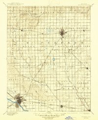
1893 Map of Hutchinson
USGS Topo · Published 1945About this map
The Arkansas River and Little Arkansas River define the southern drainage of this Central Kansas landscape, where the prairie was rapidly being partitioned by rail and township lines in the late 19th century. Major hubs like Hutchinson and McPherson are shown as established grid-planned settlements, while smaller rail stops such as Windom, Conway, and Galva trace the path of the Atchison Topeka and Santa Fe Railroad. The presence of numerous natural basins and water bodies, including Lake Inman, Lake Farland, and the distinctively named Brandy Lake, highlights the importance of surface water for the region's early agricultural development.
Find a feature on this map
65 named features on this map. Tap any name to fly to it.
Don’t see what you’re looking for? This feature index may not catch every label — zoom into the map to look around manually.
Map Details
Editions of this 1893 Hutchinson Map
5 editions found
Other maps of this area

1889 · Newton
USGS Topo · 1:125,000

1889 · Abilene
USGS Topo · 1:125,000

1889 · Cheney
USGS Topo · 1:125,000

1889 · Wichita
USGS Topo · 1:125,000

1891 · Hutchinson
USGS Topo · 1:125,000

1891 · Cheney
USGS Topo · 1:125,000

1892 · Salina
USGS Topo · 1:125,000

1892 · Kingman
USGS Topo · 1:125,000

1893 · Hutchinson
USGS Topo · 1:125,000

1894 · Ellsworth
USGS Topo · 1:125,000