
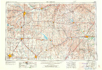
1955 Map of Hutchinson
USGS Topo · Published 1967About this map
The Arkansas River and Smoky Hill River define the agricultural and industrial heart of central Kansas in this mid-century survey. Major regional centers like Hutchinson, Salina, and Emporia anchor a landscape transitioning from traditional rail-dominated commerce to the interstate era. The emergence of significant water management projects is evident through the presence of the Marion Reservoir, Kanopolis Lake, and Council Grove Lake, which reshaped the geography of the Flint Hills and surrounding prairies. Military footprints are prominent at Fort Riley and the Smoky Hill Air Force Base, reflecting the strategic importance of the region during the Cold War. The map captures a dense network of smaller rail-stop towns such as Lindsborg, Abilene, and Peabody during a period of shifting transportation priorities.
Find a feature on this map
219 named features on this map. Tap any name to fly to it.
Don’t see what you’re looking for? This feature index may not catch every label — zoom into the map to look around manually.
Map Details
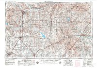
Editions of this 1955 Hutchinson Map
3 editions found
Other maps of this area

1885 · Eskridge
USGS Topo · 1:125,000

1885 · Burlington
USGS Topo · 1:125,000

1885 · Eureka
USGS Topo · 1:125,000

1886 · Fredonia
USGS Topo · 1:125,000

1886 · Junction City
USGS Topo · 1:125,000

1888 · Emporia
USGS Topo · 1:125,000

1888 · Eureka
USGS Topo · 1:125,000

1888 · Eldorado
USGS Topo · 1:125,000

1889 · Burlingame
USGS Topo · 1:125,000

1889 · Newton
USGS Topo · 1:125,000