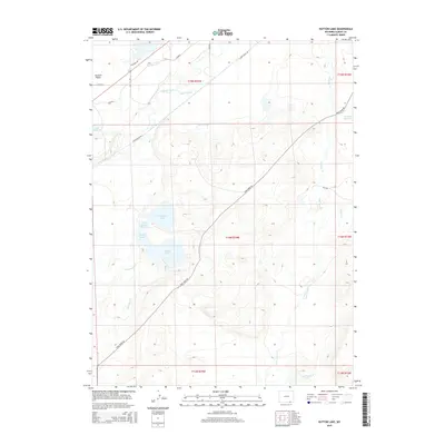
2015 Map of Hutton Lake
USGS Topo · Published 2015About this map
The Laramie Plains are defined here by a sophisticated network of early irrigation and water management infrastructure, where the Laramie River feeds a complex of ditches and reservoirs. These features, including the Monolith Ditch, Pioneer Lateral, and Dowlin Ditch, speak to the critical role of water engineering in supporting Wyoming's high-altitude ranching economy. Centered on the Hutton Lake area, the map reveals a landscape punctuated by numerous natural and man-made water bodies such as Creighton Lake, Sportsman Lake, and the Goforth Reservoir. The land is further divided by several named ranching routes, notably Sand Creek Rd and River Ranch Rd, reflecting the sparse but purposeful settlement patterns of Albany County. This 2015 U.S. Geological Survey representation details the drainage systems that transformed the arid plains into viable pastureland.
Find a feature on this map
28 named features on this map. Tap any name to fly to it.
Don’t see what you’re looking for? This feature index may not catch every label — zoom into the map to look around manually.
Map Details
Editions of this 2015 Hutton Lake Map
This is the sole edition of this map. No revisions or reprints were ever made.
Other maps of this area

1895 · Laramie
USGS Topo · 1:125,000

1902 · Laramie
USGS Topo · 1:125,000

1905 · Laramie
USGS Topo · 1:125,000

1906 · Laramie
USGS Topo · 1:125,000

1908 · Laramie
USGS Topo · 1:125,000

1954 · Cheyenne
USGS Topo · 1:250,000

1958 · Cheyenne
USGS Topo · 1:250,000
1962 · Miller
USGS Topo · 1:24,000
1963 · Laramie
USGS Topo · 1:24,000
1963 · Caldwell Lake
USGS Topo · 1:24,000