
1960 Map of Huxford
USGS Topo · Published 1961About this map
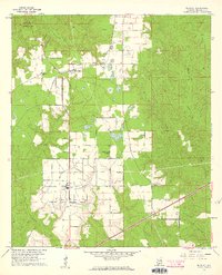
The St Louis - San Francisco Railroad corridor anchors the settlement of Huxford in this 1960 survey, illustrating the vital link between rail transport and the timber and agricultural industries of southern Alabama. The landscape is characterized by a mix of state-managed lands and family-owned parcels, with the Little River State Forest and the Edward Hauss State Forest Nursery indicating the region's long-term commitment to forest management. To the south, the extensive grounds of the Atmore State Prison Farm represent a significant institutional presence in the Escambia County countryside.
Find a feature on this map
21 named features on this map. Tap any name to fly to it.
Don’t see what you’re looking for? This feature index may not catch every label — zoom into the map to look around manually.
Map Details
Editions of this 1960 Huxford Map
4 editions found
Other maps of this area

1942 · Perdido
USGS Topo · 1:62,500

1944 · Perdido
USGS Topo · 1:62,500

1953 · Andalusia
USGS Topo · 1:250,000

1957 · Andalusia
USGS Topo · 1:250,000

1960 · Atmore
USGS Topo · 1:24,000

1960 · Barnett Crossroads
USGS Topo · 1:24,000
1960 · Flomaton
USGS Topo · 1:24,000

1972 · Frisco City SE
USGS Topo · 1:24,000

1972 · Uriah East
USGS Topo · 1:24,000

1972 · Uriah West
USGS Topo · 1:24,000