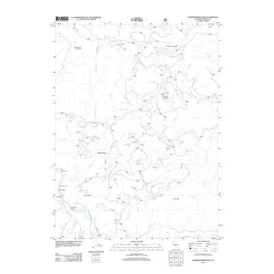
2012 Map of Hyampom Mountain
USGS Topo · Published 2012About this map
Hyampom Valley serves as the focal point for this Trinity County landscape, situated where the S Fork Trinity River meets Hayfork Cr. This 2012 survey illustrates a remote mountain environment defined by significant peaks such as Underwood Mountain, Chaparral Mountain, and Rays Peak. Settlement patterns are sparse, represented by named locations like Wigdon Place and Skunk Ranch, indicating a legacy of isolated ranching or homesteading in the drainage basins.
Find a feature on this map
35 named features on this map. Tap any name to fly to it.
Don’t see what you’re looking for? This feature index may not catch every label — zoom into the map to look around manually.
Map Details
Editions of this 2012 Hyampom Mountain Map
This is the sole edition of this map. No revisions or reprints were ever made.
Other maps of this area

1909 · Big Bar
USGS Topo · 1:96,000

1914 · Pilot Creek
USGS Topo · 1:62,500

1915 · Big Bar and Vicinity
USGS Topo · 1:250,000

1922 · China Flat
USGS Topo · 1:62,500

1951 · Pilot Creek
USGS Topo · 1:62,500

1951 · Hyampom
USGS Topo · 1:62,500

1951 · Ironside Mountain
USGS Topo · 1:62,500

1952 · Willow Creek
USGS Topo · 1:62,500

1958 · Redding
USGS Topo · 1:250,000
1978 · Blake Mountain
USGS Topo · 1:24,000