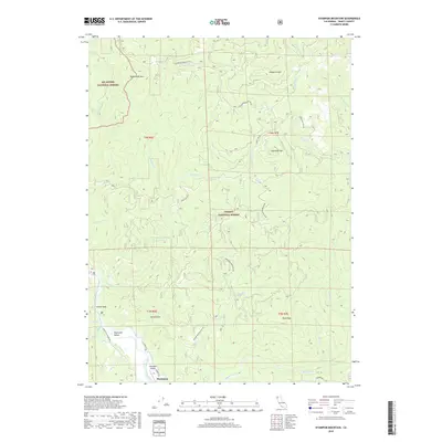
2018 Map of Hyampom Mountain
USGS Topo · Published 2018About this map
The South Fork Trinity River winds through the heart of this Trinity County landscape, anchoring the settlement of Hyampom and the broader Hyampom Valley. This 2018 survey illustrates a region defined by its high-elevation peaks and dense drainage network, where the Six Rivers National Forest meets the Trinity National Forest. The map documents the local transportation and infrastructure of the valley floor, including the Hyampom Airport and roads like Lower South Fork Rd and Hyampom Rd.
Find a feature on this map
40 named features on this map. Tap any name to fly to it.
Don’t see what you’re looking for? This feature index may not catch every label — zoom into the map to look around manually.
Map Details
Editions of this 2018 Hyampom Mountain Map
This is the sole edition of this map. No revisions or reprints were ever made.
Other maps of this area

1909 · Big Bar
USGS Topo · 1:96,000

1914 · Pilot Creek
USGS Topo · 1:62,500

1915 · Big Bar and Vicinity
USGS Topo · 1:250,000

1922 · China Flat
USGS Topo · 1:62,500

1951 · Pilot Creek
USGS Topo · 1:62,500

1951 · Hyampom
USGS Topo · 1:62,500

1951 · Ironside Mountain
USGS Topo · 1:62,500

1952 · Willow Creek
USGS Topo · 1:62,500

1958 · Redding
USGS Topo · 1:250,000
1978 · Blake Mountain
USGS Topo · 1:24,000