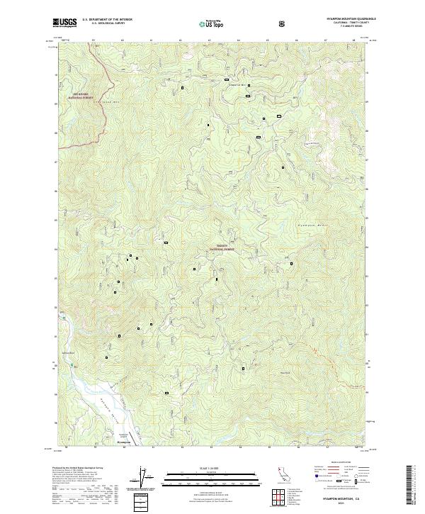
2021 Map of Hyampom Mountain
USGS Topo · Published 2021About this map
Hyampom Valley serves as the focal point for this 2021 survey, where the Trinity Wild and Scenic River and Hayfork Creek meet. This remote corner of Trinity County is defined by the intersection of the Six Rivers National Forest and the Trinity National Forest, creating a landscape dominated by dramatic peaks like Underwood Mtn and Chaparral Mtn. The small settlement of Hyampom and its nearby Hyampom Airport are situated along the riverbanks, reachable by winding mountain routes such as Corral Bottom Rd. The map illustrates a high-elevation network of drainages, including Eltapom Cr and Olsen Cr, which feed the river system. Notable landmarks such as Salmon Rock and Rays Peak provide orientation within this densely forested and complex watershed.
Find a feature on this map
39 named features on this map. Tap any name to fly to it.
Don’t see what you’re looking for? This feature index may not catch every label — zoom into the map to look around manually.
Map Details
Editions of this 2021 Hyampom Mountain Map
This is the sole edition of this map. No revisions or reprints were ever made.
Other maps of this area

1909 · Big Bar
USGS Topo · 1:96,000

1914 · Pilot Creek
USGS Topo · 1:62,500

1915 · Big Bar and Vicinity
USGS Topo · 1:250,000

1922 · China Flat
USGS Topo · 1:62,500

1951 · Pilot Creek
USGS Topo · 1:62,500

1951 · Hyampom
USGS Topo · 1:62,500

1951 · Ironside Mountain
USGS Topo · 1:62,500

1952 · Willow Creek
USGS Topo · 1:62,500

1958 · Redding
USGS Topo · 1:250,000
1978 · Blake Mountain
USGS Topo · 1:24,000