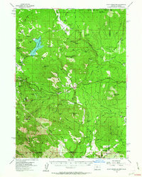
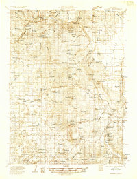
1955 Map of Hyatt Reservoir
USGS Topo · Published 1963About this map
Hyatt Reservoir dominates this mid-century landscape in the high Cascades, where the water economy and ranching intersect. The map documents a network of high-elevation prairies and glades, such as Cottonwood Glades and Johnson Prairie, supporting operations like the Schoolhouse Ranch and Summit Ranch. Industrial and transportation footprints are evident at Lincoln, which featured a Millpond and proximity to the Mt View Airport, indicating the importance of timber and localized aviation in this period. Southward, the terrain climbs into the Siskiyou Mountains, where peaks like Soda Mtn and Hobart Peak overlook a rugged watershed defined by Jenny Creek and Dead Indian Creek. This survey captures the region just before significant modern development, preserving the locations of remote outposts like Cabin 69 and the Box D Ranch.
Find a feature on this map
73 named features on this map. Tap any name to fly to it.
Don’t see what you’re looking for? This feature index may not catch every label — zoom into the map to look around manually.
Map Details
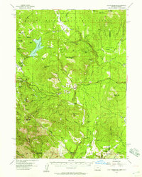
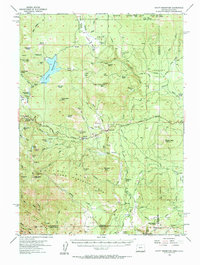
Editions of this 1955 Hyatt Reservoir Map
3 editions found
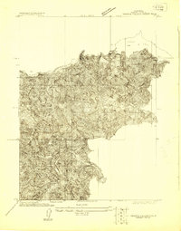
Other maps of this area

1886 · Shasta
USGS Topo · 1:250,000

1891 · Ashland
USGS Topo · 1:250,000

1893 · Ashland
USGS Topo · 1:250,000

1894 · Shasta
USGS Topo · 1:250,000

1897 · Ashland
USGS Topo · 1:250,000
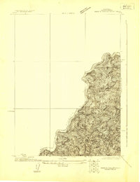
1922 · Shasta Valley Sheet No 16
USGS Topo · 1:24,000
1922 · Shasta Valley Sheet No 15
USGS Topo · 1:24,000

1932 · Yreka
USGS Topo · 1:96,000
1934 · Macdoel
USGS Topo · 1:96,000

1938 · Medford
USGS Topo · 1:125,000