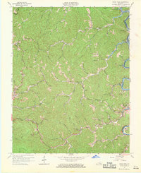
1961 Map of Hyden West
USGS Topo · Published 1970About this map
The Middle Fork Kentucky River snakes through the heart of Leslie County, where the rising waters of the Buckhorn Reservoir began to alter the river valley. This 1961 revision documents a landscape defined by its hollows and narrow ridgelines, where small settlements like Thousandsticks and Sizemore are connected by winding creeks and the Elkhorn Trail. The topography is densely marked with signs of local industry and social life, including several scattered mines, gas wells, and family-named landmarks such as Asher Branch and Muncy Creek.
Find a feature on this map
62 named features on this map. Tap any name to fly to it.
Don’t see what you’re looking for? This feature index may not catch every label — zoom into the map to look around manually.
Map Details
Editions of this 1961 Hyden West Map
2 editions found
Other maps of this area

1891 · Manchester
USGS Topo · 1:125,000

1891 · Hazard
USGS Topo · 1:125,000

1913 · Buckhorn
USGS Topo · 1:62,500

1916 · Hyden
USGS Topo · 1:48,000

1919 · Hyden
USGS Topo · 1:62,500

1953 · Buckhorn
USGS Topo · 1:24,000

1953 · Hyden West
USGS Topo · 1:24,000

1953 · Big Creek
USGS Topo · 1:24,000

1953 · Mistletoe
USGS Topo · 1:24,000

1954 · Krypton
USGS Topo · 1:24,000