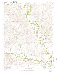
1957 Map of Hymer
USGS Topo · Published 1979About this map
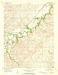
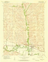
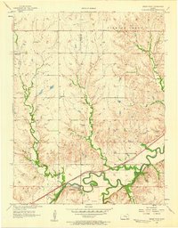
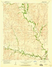
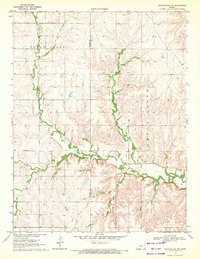
Diamond Creek meanders through the heart of the Flint Hills in this mid-century survey, defining a landscape of narrow agricultural valleys tucked between undulating prairie uplands. The small settlement of Hymer serves as a northern anchor along the creek, while to the south, the village of Elmdale sits near the confluence where Middle Creek meets the Cottonwood River. This area is shaped significantly by the presence of the Atchison Topeka and Santa Fe railroad, which follows the river corridor and connects these rural communities to the broader region.
Find a feature on this map
16 named features on this map. Tap any name to fly to it.
Don’t see what you’re looking for? This feature index may not catch every label — zoom into the map to look around manually.
Map Details
Editions of this 1957 Hymer Map
2 editions found
Other maps of this area

1889 · Parkerville
USGS Topo · 1:125,000

1894 · Parkerville
USGS Topo · 1:125,000

1898 · Cottonwood Falls
USGS Topo · 1:125,000

1955 · Hutchinson
USGS Topo · 1:250,000
1957 · Elmdale
USGS Topo · 1:24,000
1957 · Strong City
USGS Topo · 1:24,000
1957 · Cedar Point
USGS Topo · 1:24,000
1957 · Hymer
USGS Topo · 1:24,000

1959 · Hutchinson
USGS Topo · 1:250,000
1970 · Lincolnville NE
USGS Topo · 1:24,000