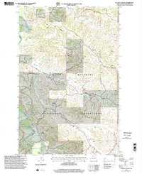
1997 Map of Ice Box Canyon
USGS Topo · Published 2001About this map
The Little Missouri National Grasslands define this corner of McKenzie County, where the Little Missouri River carves a winding path through a complex landscape of drainages and plateaus. This 1997 revision documents a working landscape where traditional ranching and modern energy extraction coexist. Named properties like the L Trotter Ranch, R Carson Ranch, and E Trotter Ranch sit near landmarks such as Ice Box Canyon and Flat Top Butte.
Find a feature on this map
23 named features on this map. Tap any name to fly to it.
Don’t see what you’re looking for? This feature index may not catch every label — zoom into the map to look around manually.
Map Details
Editions of this 1997 Ice Box Canyon Map
This is the sole edition of this map. No revisions or reprints were ever made.
Other maps of this area

1953 · Watford City
USGS Topo · 1:250,000

1957 · Watford City
USGS Topo · 1:250,000

1958 · Sperati Point
USGS Topo · 1:24,000

1967 · Watford City
USGS Topo · 1:250,000

1970 · Eagle Draw
USGS Topo · 1:24,000

1970 · Hanks Gully
USGS Topo · 1:24,000
1972 · Burning Mine Butte
USGS Topo · 1:24,000

1974 · Wolf Coulee
USGS Topo · 1:24,000

1974 · Squaretop Butte
USGS Topo · 1:24,000
1974 · Ice Box Canyon
USGS Topo · 1:24,000