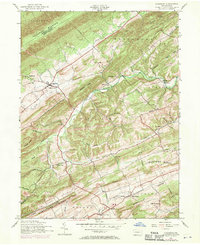
1952 Map of Ickesburg
USGS Topo · Published 1970About this map
Tuscarora Mountain and a series of parallel ridges dominate this 1952 topographic study of Perry County, revealing a landscape defined by deep valleys and traditional rural settlements. At the center of the sheet, the village of Ickesburg serves as a local hub, anchored by the Ickesburg High School and situated along Buffalo Creek. The map documents the persistent agricultural and spiritual character of the region through numerous small hamlets like Eshcol, Mannsville, and the curiously named Little Germany, each marked by its own local landmarks such as the Eshcol Memorial Cemetery or Wesley Chapel.
Find a feature on this map
53 named features on this map. Tap any name to fly to it.
Don’t see what you’re looking for? This feature index may not catch every label — zoom into the map to look around manually.
Map Details
Editions of this 1952 Ickesburg Map
4 editions found
Other maps of this area

1907 · New Bloomfield
USGS Topo · 1:62,500

1907 · Millerstown
USGS Topo · 1:62,500

1925 · Mifflintown
USGS Topo · 1:48,000

1930 · Loysville
USGS Topo · 1:62,500

1933 · Loysville
USGS Topo · 1:62,500

1934 · Mifflintown
USGS Topo · 1:62,500

1937 · Mifflintown
USGS Topo · 1:62,500

1943 · Millerstown
USGS Topo · 1:62,500

1943 · New Bloomfield
USGS Topo · 1:62,500

1950 · Harrisburg
USGS Topo · 1:250,000
Featured Places
- Saville Township, PA
- Centre Township, PA
- Tuscarora Township, PA
- Little Germany, Spring Township
- Eshcol, Saville Township