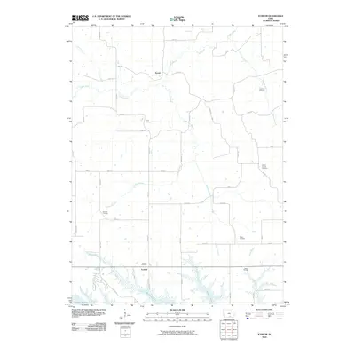
2010 Map of Iconium
USGS Topo · Published 2010About this map
Iconium and the surrounding Appanoose County landscape are defined by a complex network of stream branches and early burial grounds that trace the settlement history of southern Iowa. The northern reaches are drained by Contrary Creek and Cedar Creek, while the southern portion of the map is dominated by the sprawling waters of Rathbun Lake. This reservoir significantly altered the original courses of Honey Creek and Buck Branch, creating a jagged shoreline that now borders the community of Iconium.
Find a feature on this map
48 named features on this map. Tap any name to fly to it.
Don’t see what you’re looking for? This feature index may not catch every label — zoom into the map to look around manually.
Map Details
Editions of this 2010 Iconium Map
This is the sole edition of this map. No revisions or reprints were ever made.
Other maps of this area

1924 · Melcher
USGS Topo · 1:62,500

1929 · Albia
USGS Topo · 1:62,500

1935 · Russell
USGS Topo · 1:62,500

1938 · Russell
USGS Topo · 1:62,500

1939 · Mystic
USGS Topo · 1:62,500

1942 · Mystic
USGS Topo · 1:62,500

1954 · Centerville
USGS Topo · 1:250,000

1954 · Des Moines
USGS Topo · 1:250,000

1956 · Des Moines
USGS Topo · 1:250,000

1957 · Des Moines
USGS Topo · 1:250,000