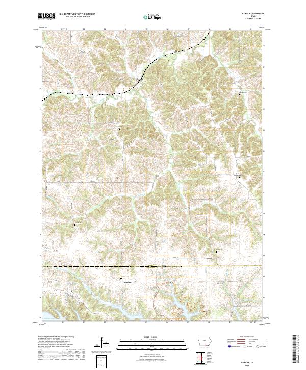
2022 Map of Iconium
USGS Topo · Published 2022About this map
Iconium and Tyrone anchor this rural landscape along the border of Monroe and Appanoose Counties. The terrain is defined by a dense network of drainage, where Mormon Br and Moffatt Br carve through the undulating countryside toward the southern reaches of Honey Creek. Near the southern edge of the sheet, the waters of Rathbun Lake meet the rising elevations of Savanna Ridge, illustrating the relationship between the regional reservoir system and the surrounding uplands. For genealogists, the map is particularly valuable for its density of small burial grounds, including the Iconium Cem, Welch Cem, and Brandon Cem. The grid of secondary roads like Co Rd T13 and j18 connects these remote settlements and historic family sites, preserving the spatial layout of this agricultural community as it remains in the early 21st century.
Find a feature on this map
68 named features on this map. Tap any name to fly to it.
Don’t see what you’re looking for? This feature index may not catch every label — zoom into the map to look around manually.
Map Details
Editions of this 2022 Iconium Map
This is the sole edition of this map. No revisions or reprints were ever made.
Other maps of this area

1924 · Melcher
USGS Topo · 1:62,500

1929 · Albia
USGS Topo · 1:62,500

1935 · Russell
USGS Topo · 1:62,500

1938 · Russell
USGS Topo · 1:62,500

1939 · Mystic
USGS Topo · 1:62,500

1942 · Mystic
USGS Topo · 1:62,500

1954 · Centerville
USGS Topo · 1:250,000

1954 · Des Moines
USGS Topo · 1:250,000

1956 · Des Moines
USGS Topo · 1:250,000

1957 · Des Moines
USGS Topo · 1:250,000