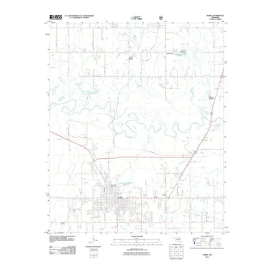
2010 Map of Idabel
USGS Topo · Published 2010About this map
Idabel serves as the focal point of this study, positioned south of the winding Little River in McCurtain County. The map details the local road network connecting the town center to surrounding rural communities, including the residential areas of Choctaw Village and Holly Creek. The landscape is defined by its hydrology, where numerous tributaries like Lukfata Creek, Salt Creek, and Mud Creek feed into the river system. Local infrastructure is noted by several managed water bodies such as the Oknoname 089010 Reservoir and several small lakes including Thomas Lake, Twin Lake, and Pine Lake. For researchers of local history, the map provides precise locations for both the Denison Cemetery and Canfield Cemetery, alongside the small northern settlement at Crossroads. The presence of the HWY 70 BYP and major arterial roads like SW Hugo Ave illustrates the modern development pattern of the region while maintaining its proximity to the natural river bottomlands.
Find a feature on this map
27 named features on this map. Tap any name to fly to it.
Don’t see what you’re looking for? This feature index may not catch every label — zoom into the map to look around manually.
Map Details
Editions of this 2010 Idabel Map
This is the sole edition of this map. No revisions or reprints were ever made.
Other maps of this area

1902 · Lukfata
USGS Topo · 1:125,000

1950 · Mcalester
USGS Topo · 1:250,000

1950 · Idabel
USGS Topo · 1:24,000

1950 · Acworth
USGS Topo · 1:24,000

1950 · Shults
USGS Topo · 1:24,000

1950 · Haworth
USGS Topo · 1:24,000

1951 · Idabel
USGS Topo · 1:24,000

1951 · Garvin
USGS Topo · 1:24,000

1951 · Idabel SE
USGS Topo · 1:24,000

1951 · Haworth
USGS Topo · 1:24,000