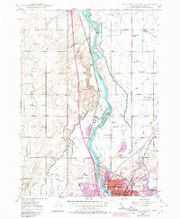
1948 Map of Idaho Falls North
USGS Topo · Published 1980About this map
The Snake River corridors north of Idaho Falls are defined by an intricate network of irrigation systems developed to support the region's agricultural expansion. Numerous named canals, such as the Great Western Canal, Osgood Canal, and Idaho Canal, divert river water to feed the high desert plains. This landscape is dotted with early 20th-century community centers, including the Coltman Ward Church, Fairview School, and St Leon Grange.
Find a feature on this map
51 named features on this map. Tap any name to fly to it.
Don’t see what you’re looking for? This feature index may not catch every label — zoom into the map to look around manually.
Map Details
Editions of this 1948 Idaho Falls North Map
4 editions found
Other maps of this area

1924 · Ammon
USGS Topo · 1:62,500

1948 · Woodville
USGS Topo · 1:24,000

1948 · Rigby
USGS Topo · 1:24,000

1948 · Lewisville
USGS Topo · 1:24,000

1948 · Idaho Falls North
USGS Topo · 1:24,000

1948 · Idaho Falls South
USGS Topo · 1:24,000

1948 · Ucon
USGS Topo · 1:24,000

1949 · Ucon
USGS Topo · 1:24,000

1949 · Idaho Falls North
USGS Topo · 1:24,000

1949 · Rigby
USGS Topo · 1:24,000