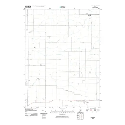
2010 Map of Idaville
USGS Topo · Published 2010About this map
Idaville anchors the southern edge of this White County landscape, where the flat agricultural terrain is meticulously organized by a grid of rural roads and an extensive network of drainage systems. Managed waterways such as Ackerman Ditch, Burgett DITCH, and Timmons Ditch underscore the region's reliance on sophisticated water management to sustain its farm fields. Small, localized settlements like Sitka and Bell Center appear as quiet crossroads, marking the slow-paced development of the northern plains.
Find a feature on this map
51 named features on this map. Tap any name to fly to it.
Don’t see what you’re looking for? This feature index may not catch every label — zoom into the map to look around manually.
Map Details
Editions of this 2010 Idaville Map
This is the sole edition of this map. No revisions or reprints were ever made.
Other maps of this area

1953 · Danville
USGS Topo · 1:250,000

1955 · Danville
USGS Topo · 1:250,000

1956 · Danville
USGS Topo · 1:250,000

1962 · Buffalo
USGS Topo · 1:24,000

1962 · Burrows
USGS Topo · 1:24,000

1962 · Monticello South
USGS Topo · 1:24,000

1962 · Monon NE
USGS Topo · 1:24,000

1962 · Star City
USGS Topo · 1:24,000

1962 · Burnettsville
USGS Topo · 1:24,000

1962 · Monticello North
USGS Topo · 1:24,000